Dates that fall outside the chronology, as reflecting backward, such as maps and narratives, composed after the facts of exploration, are in [brackets.] Documents that are letters of intent, contracts to conduct a voyage, the orders of a monarch, etc., are listed as events rather than documents, not bracketed. Events not cited by Morison are in (parentheses.)
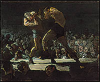
Morison asserts that Cogs of the 1200s could handle heavy seas better than modern yachts, but that contrary winds and lack of navigational instruments and pre-charted locations made two-way trips across the North Atlantic very unlikely. The Cog would develop into various forms of ships recognizable to the modern eye. A caulk called oakum, made of shredded hemp fibers, was necessary to keep these ships water tight. Heavy seas or neglect could cause such ships to “spew” this caulk and sink, as if drunk by the sea. Morison describes an ever-filling graveyard of wooden ships up to 1600 when deadly experience had taught her 200 year lesson to the explorers. Pavesses, or decorative shields, were mounted “viking” style at the waist of the ship, representing “supercargo” or noble adventurer passengers, often sailing in support of the captain against the crews, who were prone to mutiny. Crews had in their number, especially in voyages of royal discovery, convicts from prison, the prequel to planting “trash” or “rubbish men,” in new lands, to relieve prison overcrowding and urban unemployment. The crews were also likely to include fishermen, who had been forced or “convinced” or “pressed” by captains and merchants, who all, it does seem, doubled as pirates, in action and intent. Morison, offhandedly, does note that the origins of American restive politics, of a deep distrust of government, were pre-existing on board ship long before any viable settlement had been established by government decree. Sailors were influenced by ancient pagan beliefs, such as that “unbaptized infants” buried at the foot of a tree, made a ship built from that timber fortunate.
This general chronology is not comprehensive as to discoveries of and conditions in what became English North America by 1763. Rather, we are establishing the inspirations for and methods of the passage to the plantations, which managed to transport whole, the volcanic social conditions of Europe to America. These voyages were financed and captained by merchants and aristocratic adventurers whose fortunes were lost as often as the lives of their disposable rope workers, who mostly preferred fishing and hunting to hazarding exploration, just as their masters preferred piracy in known waters to the discovery of new harbors. This, and the three following chronologies, will overlap, as these are studies of specific efforts to bypass North America, use it as a base for trade with tribes and piracy against nations, and finally to plant it with already discontent populations tasked with building an overseas economy and at the same time propagate a religion compatible with imperial economics. [1]
North Atlantic Chronology
-The Canary Islands known since Antiquity, were the watering and west wind catching station for Southern and Central America, then northeast up the east coast of North America. [2]
-1152 to 1180, The Laws of Oleron, of the sea, stipulate that a master may strike a sailor, but only once. If he continues to beat the fellow, the sailor might defend himself. Boys, youths, often abducted orphans, may be beaten more often. At least 1 cat is to be taken against rats.
-1325, Dulcert Chart located Hy Brasil near Ireland, a mythic realm perhaps based on Nordic lore or notions out of Antiquity.
-1367, Pizzigani Chart propagates Atlantic with fictional islands, perhaps based on reports of Madeira or Azores by storm tossed mariners returning from the Canaries who did not accurately chart these locations
-1400, single masted ships are the rule, and have great difficulty navigating east and west across the Atlantic
-1419, Madeira Islands discovered
-1420, Center for Exploration and hydrography established in Portugal by royal decree
-1424, [Antilia, Isle of the Seven Cities, appears on hopeful Pizzi Nautical Chart in rough position of Azores, it and the other mythical islands on it number the same, but with more land area, than actual Azores. The chart was based on a Venetian chart.]
-1431, Cabral seeks Azores or Hawk Islands
-1432, First Azore found
-1434, Gil Eanes rounds Cape Bojador, Africa
-1439, four more Azores discovered
-1441, Antao Concalves brings slaves and gold back from Africa
-1443, Azores established as Portuguese territory and settled
-1447, [1563 account] claims a Portuguese discovery of Visagothic people settled on an island, being descendants of an A.D. 743 exodus by 7 bishops
-1452, Flores and Corvo, Azores 6 and 7, discovered by Valesco
-1453, Flores and Corvo granted as fiefs
“The Ocean had loosed her chains as Seneca prophesied…” -Morison
-1462, a fantastical island granted as a charter to Fernando, based on a mistaken sighting by a certain Fernandes
-1471, (Columbus shipwrecked on Iceland, probably learning of North America from fishermen)
-1474, islands to be discovered granted to Teles
-1475, Teles granted a deed to a fantastical Island of Seven Cities, beginning the storied hunt for El Dorado
-1474, Paul Toscanelli’s letter to Columbus convinces him of his westward purpose. Many of the actual Atlantic discoveries were based on hopeful fancies
-1480, Hastings Manuscript illustrates ocean capable sailing ships.
-1480, wages for sailors are the norm, superseding “share” systems except among fishermen, pirates and privateers.
-1481, King Afonso continues the Portuguese monarchy’s maritime support
-1484, letter of donation for islands to be discovered by a captain of Madeira
-1486, Afonso issues letter to “find and rule” Isle of the Seven Cities
-The terrible westerly sailing conditions in the north Atlantic frustrates Portuguese exploration
-1492, September 25, Columbus fails to find Antilia as expected, he too having been lured west by Venetian geographical fiction
-1492, hammocks discovered by Columbus. (This technology had been lost with Antiquity, as Alexander’s men carried hammocks.)
-1493, Columbus in the tiny Nina, sailed home before a cyclonic storm that would have sunk many a modern yacht, losing all but one of his sails.
-1497, Newfoundland charted by John Cabot, navigation standards established
-1500, three masted ships are now the rule and enable return, yet still largely “blind,” voyages across the Atlantic.
-1517, Basque fishermen working off Newfoundland
-1525, Cartier’s Grande Hermine outfitted for exploration
-1527, Spanish report of an English ship having a bread oven
-1529, Ribaldo World Map, illustrates advanced “long course” sailing designs
-1541, earliest ships with gunport hatches
-1542, Grand Routier navigation guide by Garcie
-1544, Morison marks as the beginning of a general adoption of “long course” sail arrangement, from study of map illustrations. This was used for piracy, the hunt for premade Chinese commodities, and finally exploration for resources and settlement as a final desperate priority.
-1548, the Complaynt of Scotlande, a chantey poem describes the brutal life of a sailor and how he wished for “many prizes,” “for God fair,” to send, in other words, that his captain would turn pirate so that he and his mates might divvy the “spoyle.”
-1550s, a whipstaff for navigation comes into use in British navy
-1552, the bark, a new class of ship, lighter than merchants, was now being adopted for exploration
-1553, Sebastion Cabot, publishes Ordinances for northern voyages, a gallon of beer per man, per day, becoming standard, noting that the ballast in the bowels of the ship are not to be used as a latrine, a rule commonly ignored, as hanging one’s butt over the rail of the pitching ship was the method of relief for the sailor, while the captain had chamber a pot that the cabin “boy” emptied.
-1553, Willoughby Expedition
-1555, Olaus Magnus, illustrates punishments for mutiny, hand pinned with dagger to mast, keel hauling and dunking
-1566, Parliament begins establishing beacons and other markers for navigation
-1570s, the flyboat, a lighter version of the bark, requiring fewer sailors, could keep at sea with less threat of mutiny, increasing the power of the captain
-1571, mention of a “charley noble” meaning a smoke stack, for below decks oven
-1574, William Bourne’s A Regiment for the Sea
-1575, Ship’s log established at sea
-1576, Frobisher seeks Northwest Passage, his officer Christopher Hall established the altitude of the sun on June 26
-1577, Frobisher’s second voyage
-1578, Frobisher’s third voyage
-1583, Humphrey Gilbert’s voyage to Newfoundland
-1585, illustration of Grenville’s Tiger indicates gunports are common
-1588, The Mariner’s Mirror illustrates the astrolobe, half hour glass turned by a boy who may not sleep more than 29 minutes lest he be beaten with a cat o’ nine tails, and a cross staff, indicating full maturity of pre chronometer [late 1700s] navigation
-1594. John Davis writes The Seaman’s Secrets
-1596, hammocks adopted by British Navy, Martin Cortez’ Art of Navigation is translated into English
-1600, John Norden’s visual “Description” of London shows sophisticated ships capable of deep sea and coastal exploration AND with the hull capacity for planting populations
-1605, John Davis killed by Japanese pirates off Singapore
-1627, Sea Grammar by Captain John Smith
Notes
-1. No slight upon Christianity or those who brought the faith to America is intended. It will be seen that native belief systems did not support the idea of transforming mixed hunting and agriculture under dispersed tribalism, into intensive livestock management and cash crop export agriculture under concentrated civic systems. Where Christianity fits into the narrative of the Planting of America, will be covered in Mathew and The Son Of Man, the 8 part summary of Christian guidelines held by the first explorer/planters.
-2. For an excellent study Sea the Discovery of Mankind by Abfula [Editor please correct name spelling.]